Ancient Engineering · Naours, Somme, Picardy, France

Naours Underground City

Three kilometres of village-under-a-village, signed by the soldiers of the Somme

Mainstream: Medieval quarries; refuge use peaking 16th–17th centuriesAlternative: Local tradition of origins in the 3rd century AD or earlier50.04°, 2.28°

At a glance

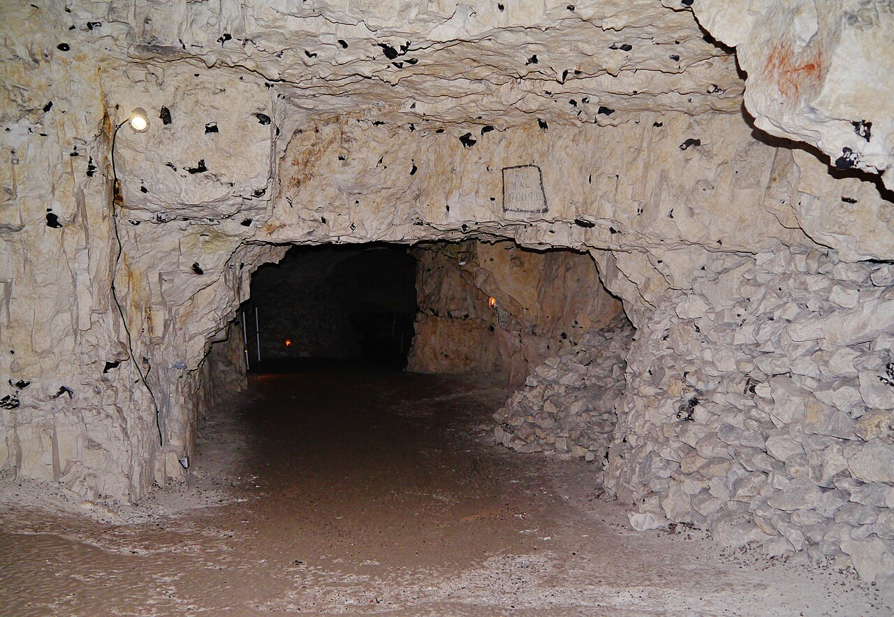
Naours Underground City
Photo: Zairon · CC BY-SA 4.0

Under a wooded chalk ridge in Picardy lies the Cité souterraine de Naours, the largest of the region's muches — refuge networks dug by villagers to survive the wars that repeatedly swept northern France. Some 33 metres down, its 3 kilometres of galleries contain around 300 rooms, public squares, chapels, stables, wells and a bakery, with chimney flues cunningly routed up through cottages on the surface so smoke would not betray the refuge. Rediscovered in 1887 by the village priest, Naours acquired a second historical treasure in the First World War, when thousands of visiting soldiers — Australians above all — pencilled and carved their names on its walls.

See it on the globe →
The mainstream view

What archaeology says

Archaeology and archives indicate that Naours began as underground chalk quarries in the Middle Ages, which villagers progressively enlarged into an organised refuge. The muches tradition — the word derives from Picard dialect for to hide — is documented across the Somme, and Naours is its grandest expression: capacity estimates run to 2,000–3,000 people plus their livestock. Use intensified during the wars of religion and the Thirty Years' War in the 16th and 17th centuries, when passing armies made surface life lethal; the complex was designed for long stays, with wells, ventilation, stabling, storage and three chapels.

After fading from memory in the quieter 18th and 19th centuries, the tunnels were rediscovered and cleared from 1887 by Abbé Ernest Danicourt, the parish priest, who spent years exploring and publicising them. During the First World War the site, lying behind the lines near Vignacourt, became an improbable tourist attraction for resting troops. Research led from 2014 by INRAP archaeologist Gilles Prilaux, originally studying the site's older history, unexpectedly catalogued nearly 3,000 items of soldiers' graffiti — the largest known concentration of First World War inscriptions on the Western Front, the majority Australian. In the Second World War the Germans requisitioned the complex, using it for headquarters and storage.

Historians note that, unlike many legendary tunnel systems, Naours is exhaustively mapped and its phases are legible in tool marks, documents and finds: a vernacular civil-defence masterpiece rather than a mystery.

Key evidence cited
  • Around 300 rooms and 3 km of galleries, fully surveyed, about 33 metres below the plateau
  • Documented muches refuge tradition across the Somme in the 16th–17th centuries
  • Chimney flues routed through surface cottages demonstrate purpose-built concealment for civilian refuge
  • Rediscovery and clearance from 1887 by Abbé Ernest Danicourt is historically recorded
  • INRAP study led by Gilles Prilaux (2014 onwards) catalogued nearly 3,000 WWI inscriptions, mostly Australian
  • German military use in WWII is documented, completing an unbroken modern history
The alternative view

What the skeptics propose

The dissenting tradition here is a local and antiquarian one. Abbé Danicourt and earlier regional writers believed the caves were far older than the surviving records — begun, they argued, in the 3rd century AD as refuges from the barbarian invasions of late Roman Gaul, and used again against Norman raiders in the 9th century. Guides at Naours long repeated this deep chronology, and it remains embedded in popular accounts, which sometimes push the first digging back to Gallo-Roman quarrying or even Iron Age souterrains of the kind known from Brittany and Scotland.

Regional enthusiasts also argue that the mapped city is only the core of something larger: Picardy's chalk is honeycombed with hundreds of known muches, many collapsed or sealed, and stories persist of passages linking Naours to churches and manors kilometres away. On this view the medieval dating reflects merely the latest, best-preserved phase of a refuge habit reaching back to antiquity.

Modern archaeologists respond that no Gallo-Roman artefact or datable early feature has been securely identified in the complex, that the documentary trail begins in the medieval period, and that long-distance connecting tunnels have never been verified. But because chalk quarrying erases its own history — each enlargement destroying earlier surfaces — they concede that a modest ancient precursor cannot be formally excluded, and Prilaux's programme treated the site's origins as a genuinely open research question.

Key evidence cited
  • Danicourt and regional antiquarians argued for 3rd-century AD origins as refuges from barbarian invasions
  • Iron Age and early medieval souterrains elsewhere in Atlantic Europe show the refuge concept is ancient
  • Chalk quarrying destroys earlier phases, so an ancient precursor would be hard to detect
  • Persistent local traditions describe unexplored passages linking Naours to distant surface sites
  • Hundreds of other muches across Picardy remain unexcavated and undated
  • The scale of Naours suggests development over a far longer span than the documented refuge centuries

Genuinely open questions

  1. When was the first gallery actually cut, and by whom?
  2. Do any unexplored or collapsed passages extend beyond the mapped 3 kilometres?
  3. How many of the WWI signatories can be traced to their fates — a project still ongoing?
  4. Why does the documentary record of so vast a refuge only begin in the medieval period?

Worth knowing

Among the thousands of names pencilled on Naours's chalk walls, researchers traced Australian soldiers who visited as sightseeing tourists on rest days from the Somme front — for many, the graffiti dated weeks or days before their deaths, making the caves an accidental war memorial.