What archaeology says
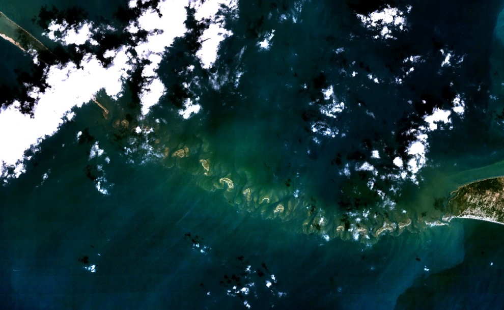
Geologists interpret Adam's Bridge as a natural feature: a chain of shoals and sandbars developed on a ridge of older limestone and coral, of a type known as a tombolo or barrier-and-shoal system, built and reshaped by longshore currents, wave action and sediment transport in the very shallow strait. The Geological Survey of India's investigations, together with satellite imagery from NASA and ISRO and high-resolution bathymetric modelling using ICESat-2 data, show a linear ridge of shoals broken by narrow channels — consistent with natural sedimentary and reef processes rather than deliberate construction.
Dating is layered and often misreported. Studies suggest the wider Rameswaram–Mannar region was intermittently exposed as sea levels fell during the last glacial period, with landmass emergence estimated across a broad window of roughly 7,000 to 18,000 years ago, while coral dating on parts of the structure has returned surprisingly recent ages, on the order of a few centuries. The much-quoted figure of '1.75 million years' derives from a misattributed television claim, not from a peer-reviewed study, and geologists reject it.
The mainstream position is therefore that the bridge is a real, striking, walkable-in-places natural formation whose components have different ages, and that the shoals sitting just below or at the water surface reflect ordinary marine geology in an extremely shallow sea — not the ruins of an engineered causeway.
- Satellite imagery (NASA Landsat, ISRO/NASA ICESat-2) showing a natural linear shoal-and-channel ridge
- Geological Survey of India work interpreting the chain as a tombolo/barrier system on a limestone base
- High-resolution bathymetric modelling consistent with sediment transport and reef processes
- Coral and sediment dating giving mixed, sometimes recent (few-century) ages for parts of the structure
- The '1.75-million-year' figure traced to a misattributed TV claim, not any peer-reviewed study