What archaeology says
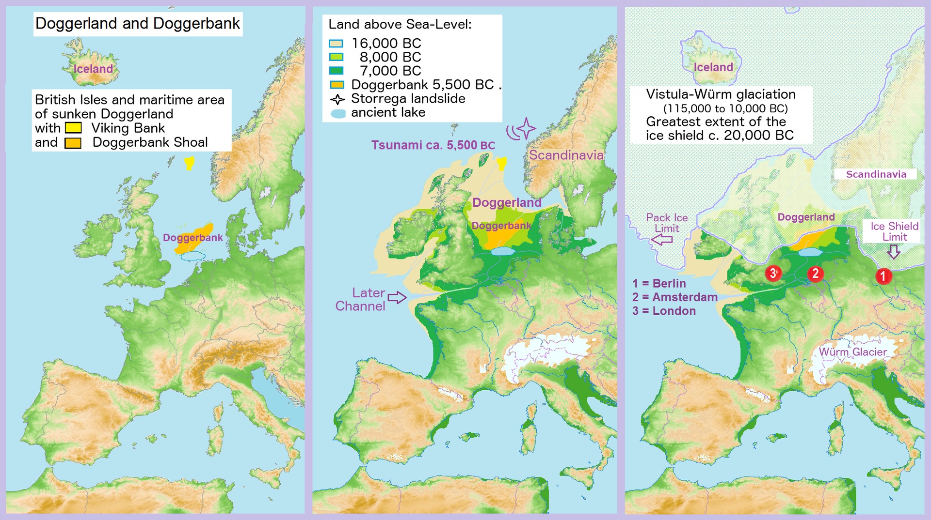
Doggerland has moved from speculation to hard science largely through the work of Vincent Gaffney and the Europe's Lost Frontiers team at the University of Bradford, who used vast seismic-reflection datasets collected by the oil and gas industry to reconstruct the buried landscape in astonishing detail — its main river system (the 'Southern River'), estuaries, lakes and hills — across nearly 200,000 square kilometres of seabed. Sediment cores drilled from targeted spots have then been analysed for pollen, microfossils and, increasingly, ancient DNA extracted directly from the sediment (sedaDNA), building a picture of a genuine lived-in environment rather than an empty land bridge.
The Storegga tsunami, dated to around 6150 BC, is recorded as a distinctive sand layer within these cores; core ELF001A off Norfolk preserves the deposit, and multiproxy analysis confirms a marine inundation. The consensus is that Doggerland was progressively drowned by post-glacial sea-level rise, with Storegga delivering a sudden, locally catastrophic blow to communities on the remaining low ground. Notably, a 2020 study by Gaffney's group argued the tsunami did not instantly sever Britain from Europe: parts of Doggerland likely survived as an archipelago of islands for some centuries afterwards before final submergence. Recent sedaDNA work, including a 2026 study, has pushed the story back further, revealing that temperate forests of oak, elm and hazel with deer, boar, bear and aurochs colonised southern Doggerland far earlier than expected.
- High-resolution seismic mapping of Doggerland's rivers, lakes and hills by Gaffney's Bradford team
- Mesolithic bone and flint tools dredged from the seabed by North Sea trawlers
- The Storegga tsunami sand layer dated to c. 6150 BC in core ELF001A off Norfolk
- Sedimentary ancient DNA (sedaDNA) revealing forests and fauna of a genuinely inhabited landscape
- A 2020 study showing Doggerland persisted as an archipelago for centuries after the tsunami