Ancient Knowledge · Nubian Desert, southern Egypt

Nabta Playa Calendar Circle

A tiny stone circle in the Sahara that may be older than Stonehenge — and, some claim, a map of the galaxy

Mainstream: c. 4800 BC (calendar circle)Alternative: c. 16,500 BC (Brophy's star-map reading)22.51°, 30.73°

At a glance

Nabta Playa Calendar Circle
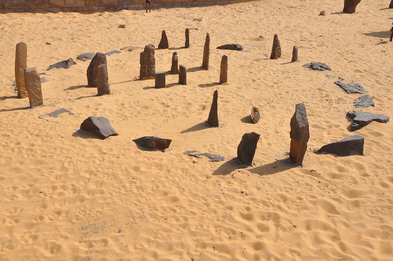
Photo: Raymbetz · CC BY-SA 3.0

Around 100 kilometres west of Abu Simbel, on the shore of a long-vanished seasonal lake, sits a modest ring of small stones barely four metres across. Discovered by Fred Wendorf's Combined Prehistoric Expedition in the early 1990s, the Nabta Playa calendar circle and its associated megalithic alignments were built by cattle-herding nomads who gathered at the lake during the African monsoon. Mainstream archaeology dates the circle to roughly 4800 BC, making it one of the oldest astronomically arranged monuments known — while astrophysicist Thomas Brophy has argued it encodes star maps reaching back more than 18,000 years.

See it on the globe →
The mainstream view

What archaeology says

Fred Wendorf, Romuald Schild and archaeoastronomer J. McKim Malville interpret Nabta Playa as a ceremonial centre used by Neolithic pastoralists between roughly 7500 and 3400 BC. The small calendar circle contains two sight-line pairs: one aligned close to north-south, the other pointing towards sunrise at the summer solstice — the moment that heralded the life-giving monsoon rains. Malville's team also identified longer megalithic alignments radiating from a central cluster, plausibly directed at the bright stars Arcturus, Sirius and stars of Orion as they rose in the sixth and fifth millennia BC.

The excavators see the site as evidence of surprising social complexity among early Saharan herders: cattle burials under stone tumuli, deep wells, hut arrangements and sculpted bedrock beneath one mound all point to a regional gathering place with ritual significance. Malville has called it the earliest known astronomically aligned monument in the world, but he grounds that claim firmly in radiocarbon-dated Neolithic occupation layers.

When the monsoon belt shifted south around 3400 BC the region dried out and the herders dispersed — many scholars suspect towards the Nile Valley, where their cattle cults and sky-watching traditions may have fed into pre-dynastic Egyptian religion. The circle itself was relocated to the Nubian Museum in Aswan for protection.

Key evidence cited
  • Radiocarbon dates from hearths, settlements and the megalith-bearing sediments cluster between c. 7500 and 3400 BC, with the calendar circle placed around the fifth millennium BC
  • The circle's sight-lines fit a north-south axis and summer solstice sunrise — exactly the event that mattered to monsoon-dependent herders
  • Cattle burials, deep walk-in wells and arranged village plans show a complex pastoral society capable of communal construction
  • Malville's surveys match the longer megalith lines to rising positions of Sirius, Arcturus and Orion's stars at epochs consistent with the radiocarbon dates
  • The drying of the Sahara around 3400 BC coincides with rising social complexity in the pre-dynastic Nile Valley, supporting a migration link
The alternative view

What the skeptics propose

In his 2002 book The Origin Map, astrophysicist Thomas Brophy proposed a far more radical reading. He argued that the calendar circle is a diagram of Orion's Belt as it appeared on the meridian around 4900 BC — but also that other stones in the circle map the head and shoulders of Orion as they appeared around 16,500 BC, before a full precessional cycle. He further suggested the larger megalithic alignments encode the distances to the very stars they point at, and even a representation of the Milky Way galaxy's structure.

Brophy later collaborated with Robert Bauval on Black Genesis (2011), which argued that Nabta Playa's star-watching cattle herders were the direct ancestors of pharaonic civilisation, pushing the roots of Egyptian astronomy deep into a 'Black African' prehistory that conventional Egyptology, they claim, has underplayed.

Mainstream researchers have pushed back hard on the older dates. In a 2007 paper, Malville, Schild, Wendorf and Brenmer noted that Brophy's proposed alignments require dates around 1,500 years earlier than the best radiocarbon estimates for the megaliths, and most archaeoastronomers regard the star-distance and galaxy-map claims as pattern-matching that no Neolithic society could plausibly have produced. Brophy's supporters counter that the statistical fits are too neat to dismiss.

Key evidence cited
  • Brophy's meridian-transit reading of the circle's central stones closely matches the layout of Orion's Belt around 4900 BC — a fit even his critics accept as intriguing
  • The same method applied to the outer stones produces a match with Orion's head and shoulders around 16,500 BC, which Brophy argues is deliberate precessional book-keeping
  • Brophy calculates that megalith distances from the central complex correlate with the actual distances of the target stars, which he says defies coincidence
  • Bedrock beneath one tumulus was sculpted before being buried, hinting at knowledge invested in hidden, older layers of the site
  • Bauval and Brophy point to the sophistication of early Egyptian star religion as evidence of a long-matured Saharan astronomical tradition

Genuinely open questions

  1. How much of Nabta Playa's sky-lore actually survived into pre-dynastic Egyptian religion?
  2. Are the longer megalithic alignments genuinely stellar, or artefacts of selecting targets after the fact?
  3. Could any element of the site pre-date the Neolithic occupation, as Brophy's oldest dates would require?
  4. Why were valuable cattle sacrificed and buried at a desert lake hundreds of kilometres from the Nile?

Worth knowing

The entire calendar circle was moved stone by stone to the garden of the Nubian Museum in Aswan in 2008 — visitors to the original site today find only a marker in the sand.