Lost Worlds · Elounda, Mirabello Bay, Crete, Greece

Olous

A Cretan city-state whose walls ripple beneath swimmers at the Poros causeway

Mainstream: Dorian city-state flourishing 1st millennium BC; submerged by tectonic subsidence in antiquityAlternative: Local tradition of a whole city beneath the bay, sometimes inflated to Minoan or even Atlantean age35.26°, 25.73°

At a glance

Olous
Photo: Eckhard Rothfuchs · CC BY-SA 4.0

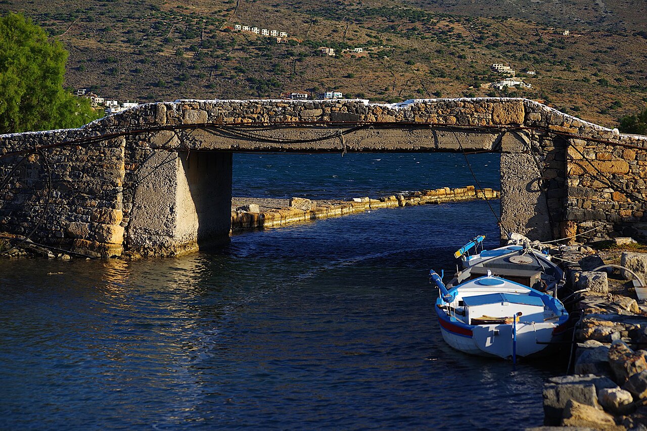
Beside the causeway that links the resort town of Elounda to the Spinalonga peninsula in eastern Crete, the outlines of ancient walls run under the shallow, glass-clear water of Mirabello Bay. These are the remains of Olous, a Dorian Greek city-state that minted its own coins — stamped with the goddess Britomartis, whose famous wooden cult statue stood in its temple — and signed treaties with Knossos, Rhodes and other powers. Olous was not destroyed in a day: eastern Crete has slowly subsided while the island's west end was heaved upward, most dramatically in the great earthquake of AD 365, and the city's lower quarters gradually passed beneath the sea. It is one of the easiest genuine sunken cities in the world to see — visible to any swimmer or walker at the right light.

See it on the globe →
The mainstream view

What archaeology says

Olous is well documented as a functioning polis of Classical, Hellenistic and Roman Crete. Inscriptions record its treaties — including a well-known alliance with Rhodes around 201-200 BC — and its long boundary disputes with neighbouring Lato, arbitrated by outside powers. Its coinage and the cult of Britomartis, along with mentions in ancient geographers, fix its identity beyond doubt. Estimates of its peak population vary widely; figures in the tens of thousands sometimes quoted in tourist literature are generally considered far too high for the site's footprint.

The submergence is tectonic. Crete sits above the Hellenic subduction zone, and while the AD 365 earthquake famously lifted western Crete by up to nine metres — stranding harbours like Phalasarna above the waves — the island's eastern end has experienced net subsidence of a few metres since antiquity. The visible walls at the Poros isthmus, together with drowned building traces around the bay, record that relative sea-level change directly. Later history layered over the site: the Venetians built salt pans in the lagoon, a French company cut the canal through the isthmus in the late 19th century, and an early Christian basilica with a fine fish mosaic survives on the shore above the sunken town.

Archaeological investigation has been intermittent — surface surveys, rescue work and, in recent years, targeted underwater survey by Greek authorities — partly because the remains lie in a busy tourist anchorage. For scholars of sea-level change, Olous is a valuable fixed point: a dated urban shoreline now measurably underwater.

Key evidence cited
  • Inscriptions record Olous's treaties, including the alliance with Rhodes c. 201-200 BC and arbitration of its border dispute with Lato
  • The city minted its own coinage, typically showing Britomartis and Zeus, confirming polis status and economic independence
  • Wall foundations and building traces are plainly visible underwater at the Poros isthmus and around the Elounda lagoon
  • Regional geodetic and geoarchaeological studies document post-Roman subsidence of eastern Crete alongside dramatic uplift of the west in AD 365
  • An early Christian basilica with a preserved fish mosaic on the adjacent shore attests continued settlement into late antiquity
  • Ancient geographic sources and the Stadiasmus place Olous on this stretch of the Mirabello coast, matching the remains
The alternative view

What the skeptics propose

Around Elounda, the sunken city has always invited embroidery. Local tradition speaks of a whole city beneath the bay, and tourist retellings regularly promote Olous into something older and grander than a Dorian polis — a Minoan city, a drowned metropolis of 30,000 or 40,000 souls, or a fragment of Atlantis conveniently located on the island many Atlantis theorists already favour. Because Crete is central to the popular theory linking Plato's Atlantis to the Minoan civilisation and the Thera eruption — an idea developed by scholars such as Spyridon Marinatos and later popularised by many others — a visibly sunken Cretan city makes an irresistible exhibit, even though its masonry is a thousand years too young for the Minoan story.

Some alternative writers also fold Olous into broader claims that the eastern Mediterranean conceals a network of drowned Bronze Age harbours, citing genuine submerged sites like Pavlopetri in Laconia as precedent and treating Olous as another node. The romantic detail that its patron goddess Britomartis — 'sweet maiden', a diving goddess who leapt into the sea to escape pursuit — presides over a city now itself beneath the water is rarely left unmentioned.

The honest position is that Olous is uncontested archaeology with contested marketing. Its value to the sunken-cities debate is as a teaching site: it shows that 'sunken city' usually means a few metres of tectonic subsidence over centuries, visible as wall lines in the shallows — not marble towers in the deep. Anyone who has snorkelled at Olous has calibrated their imagination against reality, which is perhaps the most useful thing a legend-prone field can ask of a site.

Key evidence cited
  • Local and touristic tradition of an entire drowned city beneath Elounda bay, with population figures inflated to 30,000-40,000
  • Frequent conflation of Olous with Minoan Crete, tying it to the popular Minoan-Atlantis hypothesis despite the site's later date
  • Its inclusion in 'real Atlantis' lists and documentaries as a Greek city swallowed by the sea
  • The poetic coincidence of Britomartis, a goddess who dived into the sea, as patron of a city now underwater — cited as meaningful by romantic writers
  • Claims that much grander ruins lie in the deeper water of Mirabello Bay, so far unsupported by survey

Genuinely open questions

  1. What is the full extent and plan of the submerged city, beyond the wall lines visible at the isthmus?
  2. When precisely did the lower town pass below sea level — gradually, or in steps tied to dated earthquakes such as AD 365?
  3. How large was Olous at its peak, and can systematic survey replace the inflated population guesses in circulation?
  4. Can the site be protected and presented to the thousands of summer swimmers without accelerating its erosion?

Worth knowing

Olous's patron goddess Britomartis was said to have leapt into the sea to escape King Minos — and her city followed her in: today you can swim over its walls beside the Elounda causeway.