What archaeology says
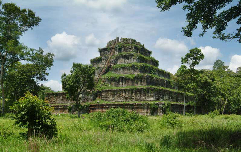
Koh Ker is one of the best-documented episodes in Khmer history. Inscriptions at Prasat Thom record the consecration of a great Shiva lingam named Tribhuvaneshvara — 'Lord of the Threefold World' — in AD 921, and the site served as capital under Jayavarman IV (r. 928–941) and briefly his son Harshavarman II, before Rajendravarman II returned the court to Angkor in 944. The Prang fits squarely within the Khmer 'temple-mountain' tradition that begins with the stepped pyramid of Bakong (881) and continues through Baksei Chamkrong and Pre Rup to Angkor Wat itself: an artificial Mount Meru raised to house the royal linga at the empire's symbolic centre. Its scale reflects Jayavarman IV's need to legitimise a contested reign — the Koh Ker style also produced some of the most dynamic sculpture in Khmer art, including the famous wrestling monkeys and fighting deities looted in the 1970s and since repatriated from the Metropolitan Museum, Sotheby's and private collections.
Modern research has been intensive. Japanese teams documented 184 monuments across the site between 2004 and 2009; excavations in December 2015 recovered more than 24,000 artefacts, with radiocarbon dates showing habitation from the 7th–8th centuries onward — before the capital's founding; and airborne LiDAR surveys led by Damian Evans in 2012–2015 mapped roads, dykes and the enormous unfinished Rahal reservoir, revealing Koh Ker as a planned hydraulic city, not an isolated folly.
One genuine oddity is acknowledged: the consecration date of 921 precedes Jayavarman IV's formal accession at Angkor, indicating he was already building a rival power centre at his home territory years before he claimed the throne — a nuance of Khmer dynastic politics, but a real one.
- The AD 921 consecration inscription of the Tribhuvaneshvara lingam at Prasat Thom
- Rich inscriptional record of Jayavarman IV's reign and the capital's move in 928
- Clear evolutionary line of Khmer temple-mountains from Bakong (881) onward
- LiDAR surveys (Damian Evans) revealing a planned 10th-century hydraulic city
- Over 24,000 artefacts from 2015 excavations consistent with 10th-century occupation