Belief & Society · Around Nevado Sajama, Oruro Department, western Bolivia

The Sajama Lines

Tens of thousands of kilometres of dead-straight paths etched across the altiplano — a sacred web older than the Inca, and the largest work of its kind on Earth.

Mainstream: Pre-Inca origins, used and remade over c. 3,000 years into recent centuriesAlternative: Date not seriously disputed — most agree the network is largely pre-Inca and long-lived; debate is over purpose and significance-18.28°, -68.69°

At a glance

The Sajama Lines
Photo: Wikimedia user Meister · CC BY-SA 3.0 / GFDL

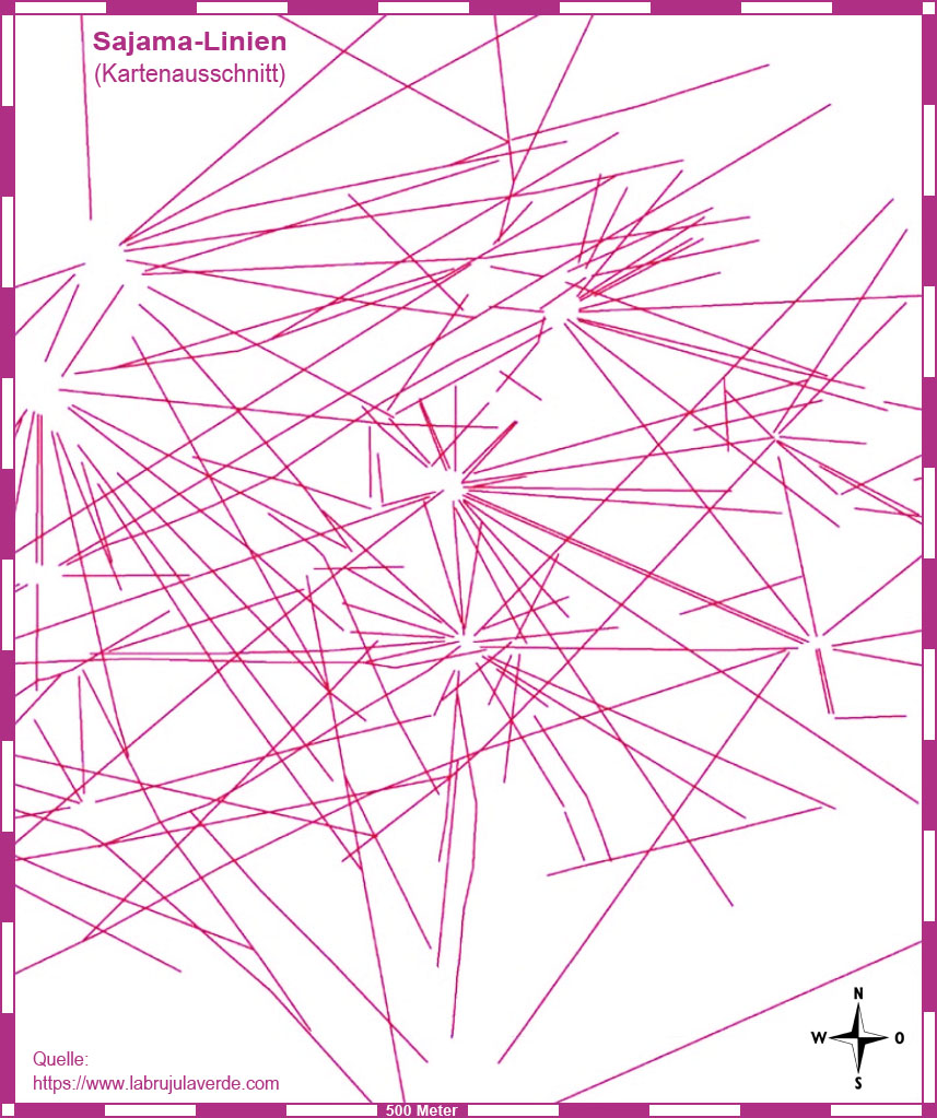
Radiating across the high, cold altiplano around the snow-capped volcano Nevado Sajama in western Bolivia is one of the most extraordinary and least-known works of the ancient Americas: the Sajama Lines. They are not figures but paths — thousands of near-perfectly straight lines scraped or trodden into the ground, some running dead straight for ten or twenty kilometres over hills, ravines and dry riverbeds without deviating. Estimates of their combined length run to around 16,000 kilometres, spread over an area of several thousand square kilometres, which would make the network many times the total length of the more famous Nazca Lines and arguably the largest single work of prehistoric line-making on the planet. The lines connect a landscape dense with meaning: at their nodes and along their courses lie wak'as (sacred places or shrines), chullpas (pre-Hispanic burial towers), hilltops, springs and small settlements. Though they cross a starkly beautiful and largely empty-looking terrain, the lines are the trace of a living Andean relationship with the land — one that in places continued to be walked and maintained into recent times.

See it on the globe →
The mainstream view

What archaeology says

Scholars regard the Sajama Lines as an indigenous Andean phenomenon with pre-Inca roots, created and re-created over a very long span — perhaps three thousand years — rather than in a single episode. Because a scraped path yields no datable organic material, ages are inferred from what the lines connect: the chullpa burial towers, wak'a shrines and settlement sites strung along them belong to pre-Hispanic Aymara-speaking cultures of the altiplano, and ethnographic work (going back to Alfred Metraux in the 1930s) documents that such straight ceremonial paths were still understood and used within Andean religious practice.

The most sustained modern study came through the Tierra Sajama project around 2003, a collaboration between the University of Pennsylvania and the Landmarks Foundation, which used GIS and aerial imagery to map the network systematically for the first time. That work confirmed the lines' astonishing straightness across rough terrain and their consistent linkage of sacred and social nodes. The leading interpretation is that they are pilgrimage and ceremonial paths: routes walked between shrines, tombs and communities, part of a sacred geography in which straightness itself carried meaning. Some researchers add a practical dimension, noting that certain lines may also have guided people to scarce water sources on the arid plateau.

The Sajama Lines fit a wider Andean pattern of ceque systems — radial sacred lines, best documented at Inca Cusco, organising the landscape into lines of shrines. Seen this way, Sajama is not an isolated marvel but the most spectacular surviving example of a widespread Andean way of inscribing devotion, memory and social order directly onto the earth.

Key evidence cited
  • Lines consistently link datable pre-Hispanic wak'a shrines, chullpa burial towers and settlements
  • Ethnographic records (from Metraux onward) of straight ceremonial paths within living Andean practice
  • Systematic GIS mapping by the Tierra Sajama project (University of Pennsylvania and Landmarks Foundation)
  • Close fit with the well-documented Andean ceque tradition of radial sacred lines, as at Inca Cusco
  • Association of some lines with routes to scarce water sources on the arid altiplano
The alternative view

What the skeptics propose

The Sajama Lines are frequently drawn into 'ley-line' and Earth-energies literature, in which straight alignments across landscapes worldwide — from English trackways to Nazca — are held to mark currents of terrestrial energy, or to encode astronomical or geometric knowledge beyond what their makers are usually credited with. In this framing the sheer scale and geometric discipline of the Sajama network, maintained across broken ground, are taken as evidence of a lost or hidden science of the land, sometimes tied to the same speculation that surrounds Nazca and Tiwanaku nearby.

Steelmanning the impulse: the lines really are astonishing, and the mainstream account leaves genuine puzzles. Keeping a path dead straight for twenty kilometres over hills and gullies demands deliberate surveying skill, and the comparison with sacred straight lines on other continents is not baseless — many cultures did invest ritual meaning in straightness, so the ley-line writers are noticing a real cross-cultural pattern even if they misexplain it.

Where the alternative accounts overreach is in the leap from 'sacred straight lines' to 'energy currents' or lost high technology. There is no measurable physical 'energy' along ley lines; controlled studies have never found one, and alignments can be generated by chance among any dense scatter of points. At Sajama the ethnographic and archaeological explanation is both sufficient and well-supported: Andean communities built and walked these paths between real, identifiable shrines and tombs as acts of devotion, using simple sighting techniques to hold their course. The straightness expresses a cultural value — the directness of a sacred route — not a physics we have forgotten. The truly remarkable fact, that ordinary highland people laid down the largest line-network on Earth for spiritual reasons, is diminished rather than enhanced by dressing it up as lost science.

Key evidence cited
  • Enormous ~16,000 km scale and geometric discipline cited as evidence of lost surveying or sacred science
  • Cross-cultural comparison with 'ley lines' and sacred straight alignments worldwide
  • The difficulty of holding lines dead straight over hills and ravines invoked as unexplained skill
  • Claims of astronomical or energetic significance encoded in the network
  • Grouping with Nazca and nearby Tiwanaku in lost-civilisation and Earth-energies literature

Genuinely open questions

  1. How can the network's construction be dated more precisely, given that scraped paths leave no organic material?
  2. Were the lines laid out over centuries by many communities, or do they reflect a more coordinated overarching plan?
  3. What surveying methods let pre-Inca builders keep paths straight for tens of kilometres across rugged terrain?

Worth knowing

Laid end to end, the Sajama Lines are estimated to total around 16,000 kilometres — roughly the distance from Bolivia to Finland — making this little-known Andean web far longer than all the Nazca Lines combined.