Lost Worlds · Between Terceira and São Miguel, Azores, Portugal (near the João de Castro Bank)

The Azores 'Underwater Pyramid', Terceira

A yachtsman's echo-sounder drew a perfect 60-metre pyramid on the Atlantic floor — the navy saw a volcano with bad resolution.

Mainstream: A natural volcanic seamount, tens of thousands of years old; the Azores were settled c. AD 1430sAlternative: A built pyramid of a pre-Portuguese or Atlantean culture, linked by some to Plato's Atlantis (destroyed c. 9600 BC)38.22°, -26.64°

At a glance

The Azores 'Underwater Pyramid', Terceira
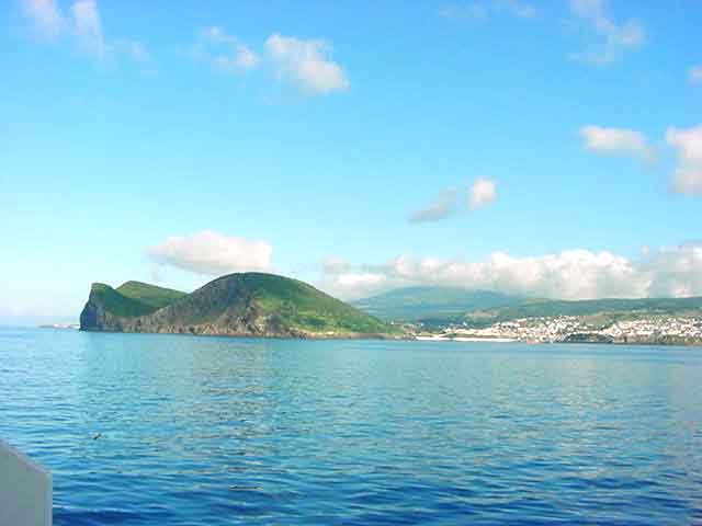
Photo: José Luís Ávila Silveira/Pedro Noronha e Costa · Public domain

In 2013, Portuguese yacht owner Diocleciano Silva was fishing in the channel between the Azorean islands of Terceira and São Miguel when his bathymetric sonar traced a startlingly regular shape on the seabed: what he described as a pyramid roughly 60 metres tall with a base of some 8,000 square metres, its faces seemingly aligned to the cardinal directions, its apex around 40 metres below the surface. The story broke on Portuguese television and raced around the world, super-charged by the Azores' long association with Atlantis speculation. The feature lies close to the João de Castro Bank, an active submarine volcano midway between the two islands. The Portuguese Navy's Hydrographic Institute examined the data and delivered a mundane verdict — but the pyramid claim had already joined a wider constellation of disputed Azorean anomalies, from the Pico 'pyramids' to claimed hypogea on Terceira.

See it on the globe →
The mainstream view

What archaeology says

The Hydrographic Institute of the Portuguese Navy, which holds detailed bathymetry of Azorean waters, reviewed the claim and concluded the feature is a natural volcanic hill, its apparently perfect geometry an artefact of the low-resolution consumer echo-sounder used to detect it. Recreational sonar interpolates sparse depth soundings into smooth surfaces, notoriously rendering rough volcanic cones as crisp geometric solids. The setting makes the natural explanation almost inevitable: the João de Castro Bank is a young, active volcano that erupted as recently as 1720, briefly building an island about a kilometre across that waves demolished within a couple of years. The seabed between Terceira and São Miguel is crowded with such cones, and none of the navy's own high-resolution surveys show anything artificial.

The wider Azorean 'pre-Portuguese' file gets similar treatment. Historical and archaeological consensus holds the islands were uninhabited when Portuguese settlers arrived in the 1430s. The pyramid-like maroiços of Pico island are explained as field-clearance cairns — generations of farmers stacking volcanic rubble as they cleared vineyard plots, a landscape UNESCO studied closely before World Heritage listing in 2004 without finding any pre-Portuguese element. Claims of rock-cut hypogea and inscriptions promoted by Nuno Ribeiro of the Portuguese Association of Archaeological Research (APIA) have not been accepted by the Regional Directorate of Culture, whose reviews found natural cavities and post-settlement features. One genuine wrinkle: a 2021 PNAS lake-sediment study led by Pedro Raposeiro found signals of livestock and land disturbance centuries before 1430, suggesting possible earlier Norse-era visits — a fascinating, legitimate debate about who reached the Azores first, but one involving mediaeval sailors, not Atlantean pyramid-builders.

Key evidence cited
  • The Portuguese Navy Hydrographic Institute identified the feature as a natural volcanic hill misrendered by low-resolution sonar
  • The nearby João de Castro Bank is an active volcano that built and lost an island as recently as 1720–1722
  • The channel between Terceira and São Miguel is dense with natural volcanic cones of similar scale
  • UNESCO's pre-2004 studies of Pico's landscape attributed the maroiços to post-settlement field clearance
  • No pre-Portuguese artefact has ever been recovered in the Azores from a secure excavated context
The alternative view

What the skeptics propose

For proponents, the Azores are the most natural address for Atlantis on the map: nine volcanic peaks rising from the Mid-Atlantic Ridge, exactly where Ignatius Donnelly placed the drowned continent's mountain-tops in his 1882 classic Atlantis: The Antediluvian World. Silva's pyramid — 60 metres tall, reportedly square to the compass — was read as a monument on a landscape drowned when the last Ice Age ended around Plato's date of 9600 BC. Advocates note that Silva was an experienced skipper using professional-grade bathymetric equipment, that the feature's reported symmetry exceeds what erosion usually leaves, and that the official explanation arrived quickly and, in their view, without a published high-resolution survey to settle the matter transparently.

The pyramid is presented as one thread in a suspicious weave. Nuno Ribeiro and Anabela Joaquinito of APIA have claimed dozens of pyramidal maroiços at Madalena on Pico are oriented to the summer solstice and resemble protohistoric ritual structures in Sicily, North Africa and the Canaries; APIA has also reported alleged hypogea, rock art and even claimed Carthaginian-era traces on Terceira and other islands, arguing for organised pre-Portuguese seafaring in the archipelago. The 2021 sediment evidence of human impact by around AD 700–850 is embraced as vindication that the 'uninhabited until 1430' orthodoxy was wrong — and if wrong about that, proponents ask, what else? The sceptical rejoinder is that each strand weakens on inspection: solstice alignments among hundreds of randomly oriented rubble cairns are expected by chance, no artefact of any ancient Mediterranean culture has ever been excavated in the Azores, early mediaeval Norse landfall is a far cry from Bronze Age or Ice Age civilisation, and the islands' volcanic geology sits 2,000 metres above the true ocean floor — the Azores were never a sunken continent.

Key evidence cited
  • Silva's 2013 bathymetric record of a ~60 m feature with reportedly square, cardinally oriented geometry
  • APIA's claims (Ribeiro and Joaquinito) of solstice-aligned pyramidal structures and hypogea on Pico and Terceira
  • The Azores' position on the Mid-Atlantic Ridge, matching Donnelly's and later authors' placements of Atlantis
  • 2021 PNAS sediment-core evidence of human and livestock impact centuries before official settlement in the 1430s
  • Absence, say proponents, of a published high-resolution survey of the specific feature to close the case openly

Genuinely open questions

  1. Will a publicly released high-resolution multibeam survey of Silva's feature end the argument definitively?
  2. Who caused the pre-Portuguese environmental disturbance detected in Azorean lake sediments — Norse voyagers or someone else?
  3. Do any of the hundreds of Pico maroiços differ structurally from field-clearance cairns in ways worth excavating?

Worth knowing

The Azores really did have a sinking landmass in historical times — the João de Castro Bank volcano erupted in 1720 and built a brand-new island a kilometre wide, which the Atlantic eroded back beneath the waves within about two years.